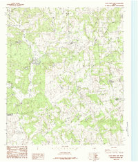
1984 Map of Coon Creek Lake
USGS Topo · Published 1984About this map
Coon Creek and its many tributaries carve through this section of the East Texas landscape along the county line between Henderson Co and Anderson Co. The area is defined by its complex hydrology, featuring a network of named water bodies such as Murchison Lake, Slaughter Lakes, and the larger Old Lake. These features, alongside Wilson Lake, suggest a history of local land management or natural depressions that have become permanent fixtures of the drainage basin.
Find a feature on this map
12 named features on this map. Tap any name to fly to it.
Don’t see what you’re looking for? This feature index may not catch every label — zoom into the map to look around manually.
Map Details
Editions of this 1984 Coon Creek Lake Map
This is the sole edition of this map. No revisions or reprints were ever made.
Other maps of this area

1949 · Palestine
USGS Topo · 1:62,500

1949 · Frankston
USGS Topo · 1:62,500

1949 · Athens
USGS Topo · 1:62,500

1949 · Tennessee Colony
USGS Topo · 1:62,500

1950 · Athens
USGS Topo · 1:62,500

1950 · Palestine
USGS Topo · 1:62,500

1950 · Frankston
USGS Topo · 1:62,500

1950 · Tennessee Colony
USGS Topo · 1:62,500

1953 · Palestine
USGS Topo · 1:250,000

1956 · Tyler
USGS Topo · 1:250,000