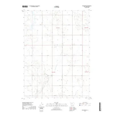
2018 Map of Coon Rapids NE
USGS Topo · Published 2018About this map
Willow Cem sits at the heart of this rural Jackson Township landscape, serving as a primary point of interest for genealogists tracing local family histories. The terrain is defined by its water management and drainage patterns, most notably the significant Dunbar Slough in the northwest and the engineered path of Drainage Ditch Number 117. These features, alongside Willow Cr and Greenbrier Cr, illustrate the agricultural character of Greene County, where the land has been carefully shaped for productivity. A strict grid of section roads, including Brentwood Ave and various lettered avenues like F Ave and G Ave, connects the farmsteads. Major county thoroughfares such as Co Hwy E57 and Co Hwy E53 provide the essential transit framework for this late 20th-century Iowa farming community.
Find a feature on this map
27 named features on this map. Tap any name to fly to it.
Don’t see what you’re looking for? This feature index may not catch every label — zoom into the map to look around manually.
Map Details
Editions of this 2018 Coon Rapids NE Map
This is the sole edition of this map. No revisions or reprints were ever made.
Other maps of this area

1954 · Bagley
USGS Topo · 1:62,500

1954 · Omaha
USGS Topo · 1:250,000

1954 · Fort Dodge
USGS Topo · 1:250,000

1957 · Omaha
USGS Topo · 1:250,000

1957 · Fort Dodge
USGS Topo · 1:250,000

1958 · Omaha
USGS Topo · 1:250,000

1958 · Fort Dodge
USGS Topo · 1:250,000

1962 · Jefferson
USGS Topo · 1:62,500

1971 · Coon Rapids South
USGS Topo · 1:24,000

1971 · Coon Rapids NE
USGS Topo · 1:24,000
Featured Places
- Jackson Township, IA
- Willow Township, IA
- Greenbrier Township, IA
- Scranton Township, IA
- Greene County, IA