1963 Map of Cooper City SW
USGS Topo · Published 1970About this map
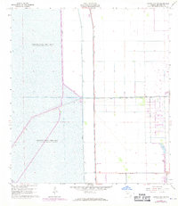
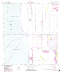
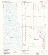
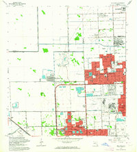
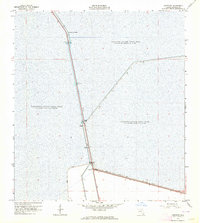
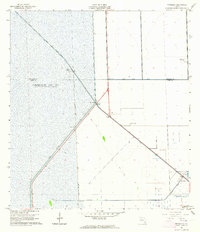
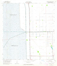
South New River Canal cuts across the center of this landscape, marking a stark divide between the controlled water impoundments of the Everglades and the burgeoning infrastructure of Broward County in the late 1960s. To the west, the vast Conservation Area No 3 and Conservation Area No 3A dominate the terrain, defined by a network of containment structures including Levee No 68A, Levee No 37, and Levee No 33. These engineering features illustrate the mid-century efforts to manage Florida's water systems. On the eastern side of the survey, the grid of Griffin Road and Hollywood Boulevard begins to push westward. The presence of a local Quarry and a Radio Tower suggests the transition from wild marshland to a more industrialized and developed suburban fringe during this era of rapid South Florida expansion.
Find a feature on this map
13 named features on this map. Tap any name to fly to it.
Don’t see what you’re looking for? This feature index may not catch every label — zoom into the map to look around manually.
Map Details
Editions of this 1963 Cooper City SW Map
4 editions found
Other maps of this area

1949 · Opalocka
USGS Topo · 1:24,000

1956 · Miami
USGS Topo · 1:250,000

1956 · West Palm Beach
USGS Topo · 1:250,000

1957 · West Palm Beach
USGS Topo · 1:250,000

1958 · West Palm Beach
USGS Topo · 1:250,000

1958 · Miami
USGS Topo · 1:250,000
1962 · Opa-locka
USGS Topo · 1:24,000
1963 · Andytown
USGS Topo · 1:24,000
1963 · Pennsuco
USGS Topo · 1:24,000
1963 · Cooper City SW
USGS Topo · 1:24,000