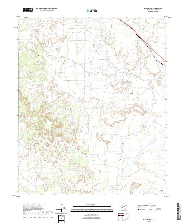
2022 Map of Cooper Creek
USGS Topo · Published 2022About this map
Agricultural water management and the rugged draws of the High Plains define this corner of Garza County. The landscape is marked by a network of named stock tanks, essential infrastructure for ranching in this arid region. These features, such as Kelly Tank and Rock Tank, are situated along the drainage systems that feed into the local creek network. The topography is dominated by the winding path of Cooper Creek and the broader valley of the Double Mountain Fork Brazos River, which cuts through the southern portion of the map. This area represents the classic cattle country of West Texas, where water sources like Crowley Tank and Frog Tank serve as vital landmarks across the rolling rangeland. The map illustrates how human activity in the early 21st century remains closely tied to the natural hydrology of the Brazos River basin.
Find a feature on this map
8 named features on this map. Tap any name to fly to it.
Don’t see what you’re looking for? This feature index may not catch every label — zoom into the map to look around manually.
Map Details
Editions of this 2022 Cooper Creek Map
This is the sole edition of this map. No revisions or reprints were ever made.
Other maps of this area

1954 · Lubbock
USGS Topo · 1:250,000

1954 · Big Spring
USGS Topo · 1:250,000

1958 · Big Spring
USGS Topo · 1:250,000

1969 · Gail NE
USGS Topo · 1:24,000

1969 · Beal Hollow
USGS Topo · 1:24,000

1969 · Fluvanna
USGS Topo · 1:24,000
1969 · Justiceburg NW
USGS Topo · 1:24,000

1969 · Post East
USGS Topo · 1:24,000

1969 · Justiceburg
USGS Topo · 1:24,000

1969 · Post West
USGS Topo · 1:24,000