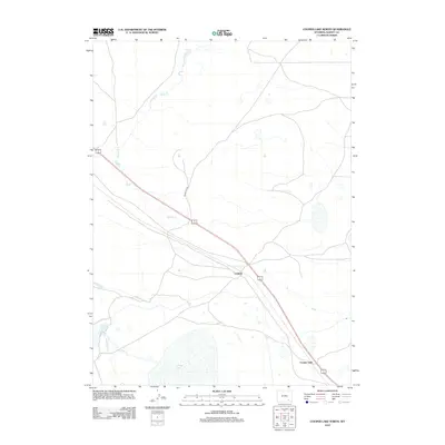
2012 Map of Cooper Lake North
USGS Topo · Published 2012About this map
The high plains of Albany County are defined by a network of water management and transit routes at the edge of Cooper Lake. This 2012 survey documents the persistent presence of ranching and railway infrastructure in this stretch of the Wyoming basin. The small settlement of Lookout sits along the primary transportation corridor, positioned near the meandering course of Meiser Cr. Water distribution is a central theme of the landscape, evident in the engineering of Homer Ditch and the proximity of Cavender Reservoir. To the south, the terrain follows the path of Dutton Cr as it approaches the wetlands and open water of the lake itself. The layout reveals how modern roads like Round Top Rd interface with the long-established rail line and natural drainage patterns of this high-altitude prairie environment.
Find a feature on this map
8 named features on this map. Tap any name to fly to it.
Don’t see what you’re looking for? This feature index may not catch every label — zoom into the map to look around manually.
Map Details
Editions of this 2012 Cooper Lake North Map
This is the sole edition of this map. No revisions or reprints were ever made.
Other maps of this area

1954 · Cheyenne
USGS Topo · 1:250,000

1955 · Bosler
USGS Topo · 1:24,000

1955 · Big Judson
USGS Topo · 1:24,000

1955 · Mc Gill Lakes
USGS Topo · 1:24,000

1955 · Cooper Lake South
USGS Topo · 1:24,000

1955 · Cooper Lake North
USGS Topo · 1:24,000

1955 · Lake Ione
USGS Topo · 1:24,000

1955 · Rock River
USGS Topo · 1:24,000

1955 · Cannonball Cut
USGS Topo · 1:24,000

1955 · Wilcox
USGS Topo · 1:24,000