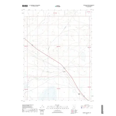
2017 Map of Cooper Lake North
USGS Topo · Published 2017About this map
Lookout sits at a critical junction in this part of Albany County, where the railroad corridor and highway cut diagonally across the high plains landscape. The drainage of Meiser Cr defines much of the northern topography, while the southern reaches are dominated by the expanse of Cooper Lake. This 2017 survey by the U.S. Geological Survey illustrates a managed water system designed for the arid environment, featuring the Homer Ditch and Cavender Reservoir. The intersection of modern infrastructure and natural watercourses like Dutton Cr reveals the spatial organization of ranching and transport in the region. Local travel is marked by named arteries such as Round Top Rd and Sand Hills Rd, which navigate the subtle ridges and basins characteristic of the Wyoming interior.
Find a feature on this map
16 named features on this map. Tap any name to fly to it.
Don’t see what you’re looking for? This feature index may not catch every label — zoom into the map to look around manually.
Map Details
Editions of this 2017 Cooper Lake North Map
This is the sole edition of this map. No revisions or reprints were ever made.
Other maps of this area

1954 · Cheyenne
USGS Topo · 1:250,000

1955 · Bosler
USGS Topo · 1:24,000

1955 · Big Judson
USGS Topo · 1:24,000

1955 · Mc Gill Lakes
USGS Topo · 1:24,000

1955 · Cooper Lake South
USGS Topo · 1:24,000

1955 · Cooper Lake North
USGS Topo · 1:24,000

1955 · Lake Ione
USGS Topo · 1:24,000

1955 · Rock River
USGS Topo · 1:24,000

1955 · Cannonball Cut
USGS Topo · 1:24,000

1955 · Wilcox
USGS Topo · 1:24,000