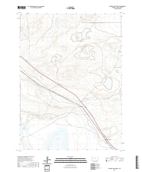
2021 Map of Cooper Lake North
USGS Topo · Published 2021About this map
Cooper Lake anchors the southern portion of this high-plains landscape in Albany County, where the sparse settlement pattern reflects the enduring ranching and transit character of the Wyoming basin. This 2021 survey illustrates how modern infrastructure, such as the rail corridor passing through Lookout, follows established geographic lines through the varied terrain. The water management system is highly visible, defined by features like Cavender Reservoir and the Homer Ditch, which redirect flow across the arid landscape. The drainage of Meiser Cr and Dutton Cr carves subtle paths through the township and range grid, while unpaved routes like Sand Hills Rd and Round Top Rd provide access to the expansive open country between the few named landmarks.
Find a feature on this map
18 named features on this map. Tap any name to fly to it.
Don’t see what you’re looking for? This feature index may not catch every label — zoom into the map to look around manually.
Map Details
Editions of this 2021 Cooper Lake North Map
This is the sole edition of this map. No revisions or reprints were ever made.
Other maps of this area

1954 · Cheyenne
USGS Topo · 1:250,000

1955 · Bosler
USGS Topo · 1:24,000

1955 · Big Judson
USGS Topo · 1:24,000

1955 · Mc Gill Lakes
USGS Topo · 1:24,000

1955 · Cooper Lake South
USGS Topo · 1:24,000

1955 · Cooper Lake North
USGS Topo · 1:24,000

1955 · Lake Ione
USGS Topo · 1:24,000

1955 · Rock River
USGS Topo · 1:24,000

1955 · Cannonball Cut
USGS Topo · 1:24,000

1955 · Wilcox
USGS Topo · 1:24,000