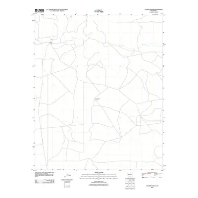
2010 Map of Cooper Ranch
USGS Topo · Published 2010About this map
Cooper Ranch and the small settlement of Cooper anchor this high-plains landscape in De Baca County, where the terrain is defined by a sparse network of ranching roads and intermittent waterways. The northern reach of the map is dominated by the winding course of Salado Creek, a seasonal drainage that carves through the open range. Local navigation relies on established routes such as County Rd-3 and County Rd-1-31, reflecting the region's historical reliance on rural infrastructure to connect isolated homesteads and pastures.
Find a feature on this map
6 named features on this map. Tap any name to fly to it.
Don’t see what you’re looking for? This feature index may not catch every label — zoom into the map to look around manually.
Map Details
Editions of this 2010 Cooper Ranch Map
This is the sole edition of this map. No revisions or reprints were ever made.
Other maps of this area

1954 · Fort Sumner
USGS Topo · 1:250,000

1958 · Fort Sumner
USGS Topo · 1:250,000

1966 · Gibbons Ranch
USGS Topo · 1:24,000

1966 · Ricardo
USGS Topo · 1:24,000

1966 · Ojo Negro Creek
USGS Topo · 1:24,000

1966 · Alamogordo Dam
USGS Topo · 1:24,000

1966 · Borica SW
USGS Topo · 1:24,000

1966 · Cooper Ranch
USGS Topo · 1:24,000

1966 · Yeso
USGS Topo · 1:24,000

1966 · Yeso NW
USGS Topo · 1:24,000