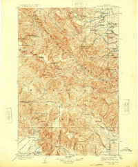
1903 Map of Coopers Lake
USGS Topo · Published 1924About this map
Lewis and Clark National Forest and Missoula National Forest converge across this rugged segment of the Continental Divide, where early 20th-century life centered on a network of isolated ranches and mining claims. Prospecting activity is prominent in the southern reaches, specifically near Copper Camp and the high ridges above Lincoln Gulch, where sites like the Klondike Mine, Porto Rico Mine, and Cotters Mine were established.
Find a feature on this map
97 named features on this map. Tap any name to fly to it.
Don’t see what you’re looking for? This feature index may not catch every label — zoom into the map to look around manually.
Map Details
Editions of this 1903 Coopers Lake Map
3 editions found
Other maps of this area

1889 · Helena
USGS Topo · 1:250,000

1893 · Helena
USGS Topo · 1:250,000

1899 · Helena
USGS Topo · 1:250,000

1902 · Ovando
USGS Topo · 1:125,000

1903 · Saypo
USGS Topo · 1:125,000

1903 · Coopers Lake
USGS Topo · 1:125,000

1903 · Helena
USGS Topo · 1:250,000

1905 · Ovando
USGS Topo · 1:125,000

1919 · Drummond
USGS Topo · 1:125,000

1920 · Choteau
USGS Topo · 1:125,000