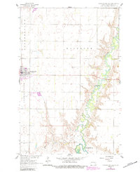
1961 Map of Cooperstown East
USGS Topo · Published 1984About this map
Sheyenne River meanders through the heart of this North Dakota landscape, carving a deep valley that contrasts with the surrounding agricultural townships. The 1961 survey, later updated in 1984, documents the eastern edge of Cooperstown and its local landmarks, including the Fairground and Cooperstown Municipal Airport. This area is defined by the transition from upland prairie to the river basin, where the Ueland Dam and several Gaging Stations monitor water levels as the river flows southward into Lake Ashtabula.
Find a feature on this map
16 named features on this map. Tap any name to fly to it.
Don’t see what you’re looking for? This feature index may not catch every label — zoom into the map to look around manually.
Map Details
Editions of this 1961 Cooperstown East Map
2 editions found
Other maps of this area

1952 · Grand Forks
USGS Topo · 1:250,000

1952 · New Rockford
USGS Topo · 1:250,000

1956 · New Rockford
USGS Topo · 1:250,000

1956 · Grand Forks
USGS Topo · 1:250,000

1961 · Cooperstown East
USGS Topo · 1:24,000

1961 · Jessie
USGS Topo · 1:24,000

1961 · Hannaford
USGS Topo · 1:24,000

1961 · Cooperstown West
USGS Topo · 1:24,000

1961 · Karnak
USGS Topo · 1:24,000

1966 · Grand Forks
USGS Topo · 1:250,000