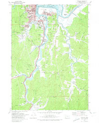
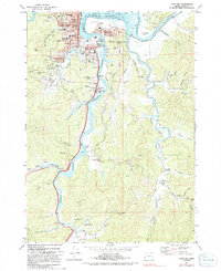
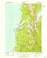
1971 Map of Coos Bay
USGS Topo · Published 1974About this map
Coos Bay serves as the focal point for this coastal survey, where the Pacific Highway and the Southern Pacific railroad converge to support a regional economy built on shipping and extraction. The landscape is defined by its complex tidal waterways, including Isthmus Slough, Catching Slough, and the Coos River, which snake through the terrain and separate neighborhoods like Eastside and Bunker Hill from the central city. Evidence of the area's industrial roots is visible in the Libby Mine and Southport Mine, alongside numerous schools and civic landmarks like the Armory and Marshfield High Sch.
Find a feature on this map
83 named features on this map. Tap any name to fly to it.
Don’t see what you’re looking for? This feature index may not catch every label — zoom into the map to look around manually.
Map Details
Editions of this 1971 Coos Bay Map
2 editions found
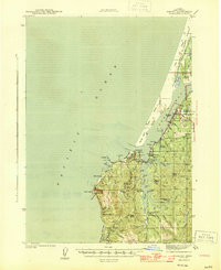
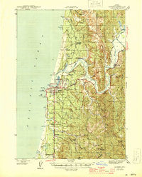
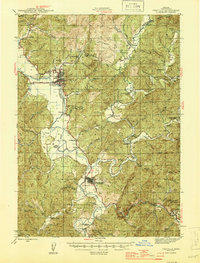
Other maps of this area

1896 · Coos Bay
USGS Topo · 1:125,000

1898 · Coos Bay
USGS Topo · 1:125,000

1900 · Coos Bay
USGS Topo · 1:125,000
1942 · Empire
USGS Topo · 1:62,500

1942 · Coquille
USGS Topo · 1:62,500
1942 · Coos Bay
USGS Topo · 1:62,500
1943 · Bandon
USGS Topo · 1:62,500
1944 · Empire
USGS Topo · 1:62,500
1944 · Bandon
USGS Topo · 1:62,500
1945 · Coquille
USGS Topo · 1:62,500