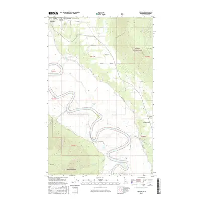
2017 Map of Copeland
USGS Topo · Published 2017About this map
The Kootenai River snakes through a deep glacial valley in this northern Idaho survey, defining the agricultural and transport corridor between the Purcell Mountains and the Kaniksu National Forest. At the northern edge, the border settlement of Porthill sits directly on the USA/Canada Boundary, where the Independent Order of Odd Fellows Cem is established on the slopes of Stein Mtn. The river's meandering course is marked by remnant water bodies like Kerr Lake and Jerome Slu, illustrating the complex hydrology of the valley floor.
Find a feature on this map
50 named features on this map. Tap any name to fly to it.
Don’t see what you’re looking for? This feature index may not catch every label — zoom into the map to look around manually.
Map Details
Editions of this 2017 Copeland Map
This is the sole edition of this map. No revisions or reprints were ever made.
Other maps of this area

1911 · Priest Lake
USGS Topo · 1:250,000

1913 · Priest Lake
USGS Topo · 1:250,000

1958 · Sandpoint
USGS Topo · 1:250,000

1963 · Sandpoint
USGS Topo · 1:250,000

1965 · Farnham Peak
USGS Topo · 1:24,000

1965 · Ritz
USGS Topo · 1:24,000

1965 · Copeland
USGS Topo · 1:24,000

1965 · Hall Mountain
USGS Topo · 1:24,000

1968 · Smith Falls
USGS Topo · 1:24,000

1969 · Pyramid Peak
USGS Topo · 1:24,000