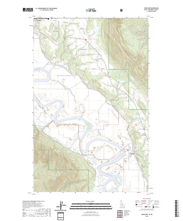
2024 Map of Copeland
USGS Topo · Published 2024About this map
The Kootenai River snakes through the deep valley floor of the Purcell Trench, a striking geographic corridor bounded by the rising slopes of the Purcell Mountains and the Kaniksu National Forest. In this northern panhandle landscape, the river’s complex meanders create distinctive oxbow features like Kerr Lake and several unnamed sloughs. The settlement of Porthill anchors the northern boundary near the international border, while the community of Copeland serves as a local hub further south, where the Copeland Cem overlooks the valley from the foothills.
Find a feature on this map
47 named features on this map. Tap any name to fly to it.
Don’t see what you’re looking for? This feature index may not catch every label — zoom into the map to look around manually.
Map Details
Editions of this 2024 Copeland Map
This is the sole edition of this map. No revisions or reprints were ever made.
Other maps of this area

1911 · Priest Lake
USGS Topo · 1:250,000

1913 · Priest Lake
USGS Topo · 1:250,000

1958 · Sandpoint
USGS Topo · 1:250,000

1963 · Sandpoint
USGS Topo · 1:250,000

1965 · Farnham Peak
USGS Topo · 1:24,000

1965 · Ritz
USGS Topo · 1:24,000

1965 · Copeland
USGS Topo · 1:24,000

1965 · Hall Mountain
USGS Topo · 1:24,000

1968 · Smith Falls
USGS Topo · 1:24,000

1969 · Pyramid Peak
USGS Topo · 1:24,000