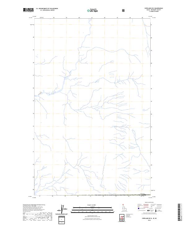
2024 Map of Copeland OE N
USGS Topo · Published 2024About this map
Boundary County, Idaho, sits along the international border in this 2024 topographic survey. The landscape is defined by a dense network of mountain streams and drainage basins flowing toward the western edge of the quadrangle. The northern border is marked by the international boundary with Canada, where the map's terrain data interfaces with the neighboring territory. This map emphasizes the natural hydrography and elevation contours of the Idaho panhandle, focusing on the undeveloped forest and mountain land characteristic of this region. The absence of primary roads and settlements highlights the isolated and rugged nature of this specific section of the Pacific Northwest, providing a clear record of the watershed patterns and natural features as they exist today.
Find a feature on this map
1 named feature on this map. Tap any name to fly to it.
Don’t see what you’re looking for? This feature index may not catch every label — zoom into the map to look around manually.
Map Details
Editions of this 2024 Copeland OE N Map
This is the sole edition of this map. No revisions or reprints were ever made.
Other maps of this area

1911 · Priest Lake
USGS Topo · 1:250,000

1913 · Priest Lake
USGS Topo · 1:250,000

1958 · Sandpoint
USGS Topo · 1:250,000

1963 · Sandpoint
USGS Topo · 1:250,000

1965 · Copeland
USGS Topo · 1:24,000

1965 · Hall Mountain
USGS Topo · 1:24,000

1968 · Smith Falls
USGS Topo · 1:24,000
1983 · Bonners Ferry
USGS Topo · 1:100,000
1996 · Hall Mountain
USGS Topo · 1:24,000
1996 · Smith Falls
USGS Topo · 1:24,000