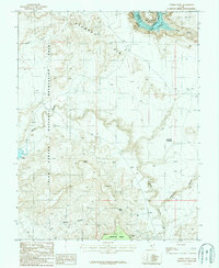
1987 Map of Copper Point
USGS Topo · Published 1987About this map
Glen Canyon National Recreation Area dominates this high-desert landscape where the Colorado River carves through the earth. The convergence of Cataract Canyon and Narrow Canyon marks the northern reaches of Lake Powell, a defining feature of the local topography. The map illustrates a complex network of drainages and high plateaus, including Browns Rim and Wingate Mesa, highlighting the isolated nature of the terrain in the late 20th century.
Find a feature on this map
19 named features on this map. Tap any name to fly to it.
Don’t see what you’re looking for? This feature index may not catch every label — zoom into the map to look around manually.
Map Details
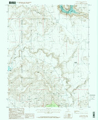
Editions of this 1987 Copper Point Map
2 editions found
Other maps of this area

1886 · Henry Mountains
USGS Topo · 1:250,000

1892 · Henry Mountains
USGS Topo · 1:250,000

1952 · Mouth of Dark Canyon
USGS Topo · 1:62,500

1952 · Mancos Mesa
USGS Topo · 1:62,500

1952 · Natural Bridges
USGS Topo · 1:62,500

1952 · Hite
USGS Topo · 1:62,500
1954 · White Canyon 2 NE
USGS Topo · 1:24,000

1954 · White Canyon 3 NW
USGS Topo · 1:24,000

1954 · White Canyon 3 NE
USGS Topo · 1:24,000
1954 · White Canyon 2 SW
USGS Topo · 1:24,000