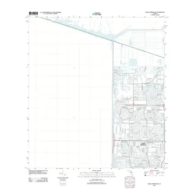
2012 Map of Coral Springs NE
USGS Topo · Published 2012About this map
The planned suburban landscape of Coral Springs stands in stark contrast to the undeveloped wetlands of the Everglades to the west, separated by the massive engineering of Levee Number 36 and the L-36 canal. This era of development is defined by dense residential networks like Wyndham Lakes Blvd N and Heron Bay Blvd, which wrap around artificial water features and golf courses. The northern boundary is marked by the historic Hillsboro Canal, a vital piece of Florida's drainage history, and the Sawgrass Expy which serves as the primary artery for this growing community. Educational and recreational hubs are prominent, including the University School of Nova University and the Clewiston Golf Course, illustrating the region's transition from marshland to a structured metropolitan edge.
Find a feature on this map
86 named features on this map. Tap any name to fly to it.
Don’t see what you’re looking for? This feature index may not catch every label — zoom into the map to look around manually.
Map Details
Editions of this 2012 Coral Springs NE Map
This is the sole edition of this map. No revisions or reprints were ever made.
Other maps of this area

1945 · Fort Lauderdale North
USGS Topo · 1:24,000

1946 · West Dixie Bend
USGS Topo · 1:24,000

1947 · Delmar Farms
USGS Topo · 1:24,000

1949 · Fort Lauderdale North
USGS Topo · 1:24,000

1949 · West Dixie Bend
USGS Topo · 1:24,000

1949 · Delmar Farms
USGS Topo · 1:24,000

1956 · West Palm Beach
USGS Topo · 1:250,000

1957 · West Palm Beach
USGS Topo · 1:250,000

1958 · West Palm Beach
USGS Topo · 1:250,000
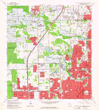
1962 · Fort Lauderdale North
USGS Topo · 1:24,000