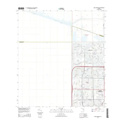
2015 Map of Coral Springs NE
USGS Topo · Published 2015About this map
Hillsboro Canal cuts a straight diagonal through the northern landscape, marking the transition from the reclaimed agricultural lands of the Everglades to the residential expansion of South Florida. This 2015 record shows the suburban growth of Parkland and the northern reaches of Coral Springs as they meet the L-40 Canal. The street network reveals a dense system of planned residential developments, characterized by named enclaves along Trails End and the golf course surroundings of Old Club Rd.
Find a feature on this map
104 named features on this map. Tap any name to fly to it.
Don’t see what you’re looking for? This feature index may not catch every label — zoom into the map to look around manually.
Map Details
Editions of this 2015 Coral Springs NE Map
This is the sole edition of this map. No revisions or reprints were ever made.
Other maps of this area

1945 · Fort Lauderdale North
USGS Topo · 1:24,000

1946 · West Dixie Bend
USGS Topo · 1:24,000

1947 · Delmar Farms
USGS Topo · 1:24,000

1949 · Fort Lauderdale North
USGS Topo · 1:24,000

1949 · West Dixie Bend
USGS Topo · 1:24,000

1949 · Delmar Farms
USGS Topo · 1:24,000

1956 · West Palm Beach
USGS Topo · 1:250,000

1957 · West Palm Beach
USGS Topo · 1:250,000

1958 · West Palm Beach
USGS Topo · 1:250,000
1962 · Fort Lauderdale North
USGS Topo · 1:24,000