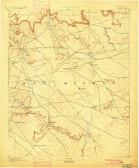
1894 Map of Corazon
USGS Topo · Published 1900About this map
Chaperito and the small valley settlements along the Gallinas river serve as the focal points of this 1890 survey of northeastern New Mexico. The landscape is defined by its massive tablelands, including Carro Mesa, Yeguas Mesa, and the central Mesa Montosa, which dictate the paths of early travel and drainage. A network of primitive roads and trails connects isolated outposts like Torres and Mentosa to reliable water sources such as Gallinas Spring and Cabra Spring.
Find a feature on this map
39 named features on this map. Tap any name to fly to it.
Don’t see what you’re looking for? This feature index may not catch every label — zoom into the map to look around manually.
Map Details
Editions of this 1894 Corazon Map
5 editions found
Other maps of this area

1889 · Las Vegas
USGS Topo · 1:125,000

1890 · Bernal
USGS Topo · 1:125,000

1891 · Bernal
USGS Topo · 1:125,000

1891 · Las Vegas
USGS Topo · 1:125,000

1892 · Watrous
USGS Topo · 1:125,000

1892 · Corazon
USGS Topo · 1:125,000

1893 · Las Vegas
USGS Topo · 1:125,000

1894 · Corazon
USGS Topo · 1:125,000

1894 · Watrous
USGS Topo · 1:125,000

1894 · Bernal
USGS Topo · 1:125,000