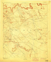
1894 Map of Corazon
USGS Topo · Published 1908About this map
The Gallinas River carves a deep valley through this high desert landscape of San Miguel County, creating a lifeline for a cluster of small settlements at the turn of the century. Along its banks, communities such as La Junta, Esterecito, and Las Colonias represent the established pastoral and agricultural presence in the region during the late nineteenth century. To the north, the plateau is dominated by massive landforms like Yegua Mesa and Mesa Montosa, which separate the river valley from the drainage of the Conchas River.
Find a feature on this map
36 named features on this map. Tap any name to fly to it.
Don’t see what you’re looking for? This feature index may not catch every label — zoom into the map to look around manually.
Map Details
Editions of this 1894 Corazon Map
5 editions found
Other maps of this area

1889 · Las Vegas
USGS Topo · 1:125,000

1890 · Bernal
USGS Topo · 1:125,000

1891 · Bernal
USGS Topo · 1:125,000

1891 · Las Vegas
USGS Topo · 1:125,000

1892 · Watrous
USGS Topo · 1:125,000

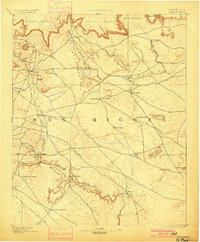
1892 · Corazon
USGS Topo · 1:125,000

1893 · Las Vegas
USGS Topo · 1:125,000

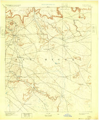
1894 · Corazon
USGS Topo · 1:125,000

1894 · Watrous
USGS Topo · 1:125,000

1894 · Bernal
USGS Topo · 1:125,000