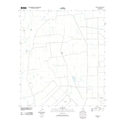
2010 Map of Cordele
USGS Topo · Published 2010About this map
The Navidad River winds through this coastal prairie landscape in Jackson County, defining the western edge of a region marked by cattle ranching and energy extraction. The small settlement of Cordele sits in the southeast corner, connected to the surrounding countryside by a network of farm-to-market roads like FM 530. The presence of the Morales Gas Field and the Fenner Ranch Airport highlights the dual economic focus of large-scale ranching and mineral resources that shape this part of Texas. For genealogists and local historians, several family-named burial sites are preserved here, including Gandy Cemetery, Miller Cemetery, and Flourney Cemetery. The hydrology is defined by numerous waterways such as Brushy Creek, Sutherland Creek, and Stem Branch, which drain the low-lying terrain. The map also records several local thoroughfares, including Morales Rd and Benne Arnold Rd, providing a detailed look at the rural infrastructure of the early 21st century.
Find a feature on this map
29 named features on this map. Tap any name to fly to it.
Don’t see what you’re looking for? This feature index may not catch every label — zoom into the map to look around manually.
Map Details
Editions of this 2010 Cordele Map
This is the sole edition of this map. No revisions or reprints were ever made.
Other maps of this area

1953 · Seguin
USGS Topo · 1:250,000

1958 · Seguin
USGS Topo · 1:250,000

1962 · Hallettsville SE
USGS Topo · 1:24,000

1963 · Ganado
USGS Topo · 1:24,000

1963 · Mount Olive
USGS Topo · 1:24,000

1964 · Cordele
USGS Topo · 1:24,000

1964 · Morales
USGS Topo · 1:24,000

1964 · Speaks
USGS Topo · 1:24,000
1964 · Navidad
USGS Topo · 1:24,000

1965 · Ganado NE
USGS Topo · 1:24,000