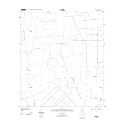
2013 Map of Cordele
USGS Topo · Published 2013About this map
The Navidad River snakes through this portion of Jackson County, anchoring a landscape defined by ranching and resource extraction. The small settlement of Cordele sits at the intersection of several local routes in the southeast, while the Morales Gas Field and Fenner Ranch Airport highlight the modern industrial and private aviation infrastructure characterizing the area. Several small family or community burial grounds, including Gandy Cem, Miller Cem, and Flourney Cem, are scattered across the terrain, providing essential landmarks for genealogists tracing regional family lines. The drainage patterns are intricate, with numerous tributaries such as Sutherland Creek, Stem Br, and Brushy Creek feeding into the river system. This survey reflects the persistence of rural Texas land divisions, where large ranch properties are segmented by a network of county roads like Co RD 280 and Co RD 284.
Find a feature on this map
31 named features on this map. Tap any name to fly to it.
Don’t see what you’re looking for? This feature index may not catch every label — zoom into the map to look around manually.
Map Details
Editions of this 2013 Cordele Map
This is the sole edition of this map. No revisions or reprints were ever made.
Other maps of this area

1953 · Seguin
USGS Topo · 1:250,000

1958 · Seguin
USGS Topo · 1:250,000

1962 · Hallettsville SE
USGS Topo · 1:24,000

1963 · Ganado
USGS Topo · 1:24,000

1963 · Mount Olive
USGS Topo · 1:24,000

1964 · Cordele
USGS Topo · 1:24,000

1964 · Morales
USGS Topo · 1:24,000

1964 · Speaks
USGS Topo · 1:24,000
1964 · Navidad
USGS Topo · 1:24,000

1965 · Ganado NE
USGS Topo · 1:24,000