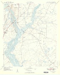
1949 Map of Cordesville
USGS Topo · Published 1949About this map
Francis Marion National Forest dominates the eastern landscape of this Berkeley County region, where the Cooper River and its West Branch serve as the primary hydrologic spine. The late 1940s topography captures a critical era of water management and industrial transit, evidenced by the Pinopolis Dam at the edge of Lake Moultrie and the engineered routes of the Tailrace Canal and Biggin Canal.
Find a feature on this map
43 named features on this map. Tap any name to fly to it.
Don’t see what you’re looking for? This feature index may not catch every label — zoom into the map to look around manually.
Map Details
Editions of this 1949 Cordesville Map
2 editions found
Other maps of this area

1919 · Summerville
USGS Topo · 1:48,000

1919 · Cordesville
USGS Topo · 1:48,000

1920 · Chicora
USGS Topo · 1:48,000

1920 · Summerville
USGS Topo · 1:62,500

1921 · Chicora
USGS Topo · 1:62,500

1943 · Chicora
USGS Topo · 1:62,500

1943 · Bonneau
USGS Topo · 1:62,500

1944 · Summerville
USGS Topo · 1:62,500

1948 · Cordesville
USGS Topo · 1:24,000

1948 · Bethera
USGS Topo · 1:24,000