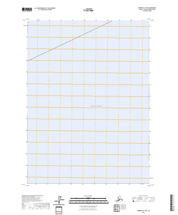
2024 Map of Cordova A-7 NE
USGS Topo · Published 2024About this map
The Gulf of Alaska occupies the entirety of this marine-focused survey, providing a precise look at open waters within the Alaska-Chugach Census Area. This 2024 edition, produced by the U.S. Geological Survey, serves as a specialized navigational and topographical reference for this specific offshore coordinate. While the map is devoid of land-based settlements, roads, or coastal features, its focus on the vast Gulf of Alaska is essential for tracking maritime boundaries and hydrographic data in these northern Pacific waters. The map includes data from the National Hydrography Dataset, emphasizing its role in modern nautical and environmental monitoring.
Find a feature on this map
1 named feature on this map. Tap any name to fly to it.
Don’t see what you’re looking for? This feature index may not catch every label — zoom into the map to look around manually.
Map Details
Editions of this 2024 Cordova A-7 NE Map
This is the sole edition of this map. No revisions or reprints were ever made.
Other maps of this area

1948 · Cordova
USGS Topo · 1:250,000

1950 · Cordova B-7
USGS Topo · 1:63,360

1951 · Cordova
USGS Topo · 1:250,000

1951 · Cordova B-6
USGS Topo · 1:63,360

1953 · Cordova B-7
USGS Topo · 1:63,360

1953 · Cordova B-6
USGS Topo · 1:63,360

1959 · Cordova
USGS Topo · 1:250,000
1997 · Cordova B-7
USGS Topo · 1:63,360
2018 · Cordova A-7 NW
USGS Topo · 1:25,000
2018 · Cordova A-7 NE
USGS Topo · 1:25,000