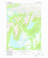
1951 Map of Cordova B-1
USGS Topo · Published 1977About this map
Carbon Camp stands as a primary focal point in this 1951 field survey, situated within the Chugach National Forest. The landscape is defined by the convergence of industrial potential and glacial terrain, marked by an Old Railroad Grade that speaks to the era's transport efforts. Large water bodies including Kushtaka Lake and Bering Lake dominate the geography, fed by the massive Martin River Glacier and Kushtaka Glacier. The map records several mineral prospects and ruins north of Stillwater Creek, alongside a Landing Strip and multiple cabins that indicate a remote but active presence. High points like Mt Hamilton 2039 and Monument Mtn 2667 provide surveying benchmarks across the Shockum Mountains. From the silt-laden Bering River to the crevassed ice fields, the map captures a specific moment of mid-century exploration and land management in the Copper River Meridian.
Find a feature on this map
52 named features on this map. Tap any name to fly to it.
Don’t see what you’re looking for? This feature index may not catch every label — zoom into the map to look around manually.
Map Details
Editions of this 1951 Cordova B-1 Map
3 editions found
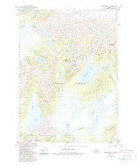
Other maps of this area

1948 · Cordova
USGS Topo · 1:250,000

1950 · Bering Glacier
USGS Topo · 1:250,000

1950 · Cordova B-2
USGS Topo · 1:63,360

1950 · Cordova A-1
USGS Topo · 1:63,360

1950 · Cordova A-2
USGS Topo · 1:63,360

1951 · Bering Glacier
USGS Topo · 1:250,000

1951 · Cordova
USGS Topo · 1:250,000

1951 · Cordova B-1
USGS Topo · 1:63,360

1953 · Cordova A-2
USGS Topo · 1:63,360

1953 · Cordova B-1
USGS Topo · 1:63,360