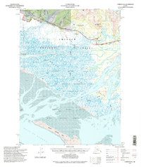
1994 Map of Cordova B-4
USGS Topo · Published 1998About this map
Merle K Smith Airport and its adjacent shooting ranges sit at the northern edge of this complex coastal landscape, where the Sheridan River and Glacier River drain toward the sea. The map documents the intricate waterways of the Copper River Delta, a region defined by shifting channels like Alaganik Slough and Storey Slough. Human presence is marked by a network of wilderness outposts, including the Tiedeman Slough Cabin and Pete Dahl Cabin, alongside the remains of Alaganik (Aband).
Find a feature on this map
53 named features on this map. Tap any name to fly to it.
Don’t see what you’re looking for? This feature index may not catch every label — zoom into the map to look around manually.
Map Details
Editions of this 1994 Cordova B-4 Map
This is the sole edition of this map. No revisions or reprints were ever made.
Other maps of this area

1948 · Cordova
USGS Topo · 1:250,000

1950 · Cordova C-4
USGS Topo · 1:63,360

1951 · Cordova
USGS Topo · 1:250,000

1951 · Cordova B-4
USGS Topo · 1:63,360

1951 · Cordova C-5
USGS Topo · 1:63,360

1951 · Cordova B-5
USGS Topo · 1:63,360

1951 · Cordova C-3
USGS Topo · 1:63,360

1952 · Cordova B-3
USGS Topo · 1:63,360

1953 · Cordova B-5
USGS Topo · 1:63,360

1953 · Cordova C-3
USGS Topo · 1:63,360