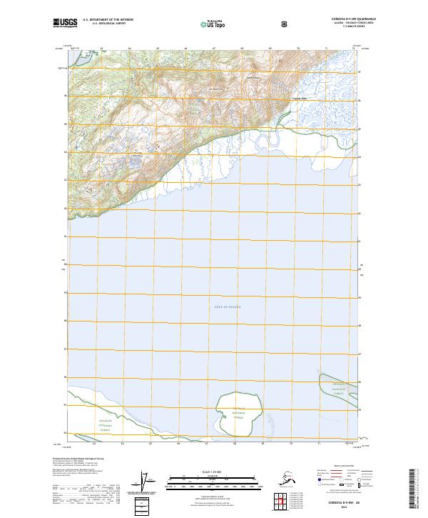
2024 Map of Cordova B-5 NW
USGS Topo · Published 2024About this map
Chugach National Forest dominates this coastal Alaska landscape where the steep elevations of the Chugach Mountains meet the waters of the Gulf of Alaska. The terrain is defined by the sharp peaks of the Heney Range, including Mt Robert Korn, which overlooks a complex hydrologic network of tidal flats and glacial runoff. Along the shoreline, Hartney Bay and the winding Mountain Slough illustrate the dynamic interface between the high-country drainage and the sea. Human access is primarily limited to the Point Whitshed Road and the Heney Ridge Trl, which provide a route into the interior wilderness. This map records the interplay of coastal sloughs like Center Slough and landmarks such as Crystal Falls, documenting the drainage patterns of this protected forest area in the Chugach Census Area.
Find a feature on this map
16 named features on this map. Tap any name to fly to it.
Don’t see what you’re looking for? This feature index may not catch every label — zoom into the map to look around manually.
Map Details
Editions of this 2024 Cordova B-5 NW Map
This is the sole edition of this map. No revisions or reprints were ever made.
Other maps of this area

1948 · Cordova
USGS Topo · 1:250,000

1950 · Cordova C-6
USGS Topo · 1:63,360

1951 · Cordova
USGS Topo · 1:250,000

1951 · Cordova C-5
USGS Topo · 1:63,360

1951 · Cordova B-5
USGS Topo · 1:63,360

1951 · Cordova B-6
USGS Topo · 1:63,360

1953 · Cordova C-6
USGS Topo · 1:63,360

1953 · Cordova B-5
USGS Topo · 1:63,360

1953 · Cordova C-5
USGS Topo · 1:63,360

1953 · Cordova B-6
USGS Topo · 1:63,360