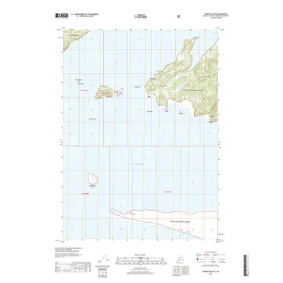
2018 Map of Cordova B-6 NE
USGS Topo · Published 2018About this map
Whitshed stands as the primary point of human interest on this coastal Alaskan landscape, situated along the complex shoreline where the Heney Range meets the water. The area is defined by the intricate waterways of Orca Inlet and Hartney Bay, which surround a series of coastal landmarks including Big Point and Gravel Point. These shores are part of the vast Chugach National Forest, illustrating a environment where the maritime and mountain landscapes are deeply integrated.
Find a feature on this map
21 named features on this map. Tap any name to fly to it.
Don’t see what you’re looking for? This feature index may not catch every label — zoom into the map to look around manually.
Map Details
Editions of this 2018 Cordova B-6 NE Map
This is the sole edition of this map. No revisions or reprints were ever made.
Other maps of this area

1948 · Cordova
USGS Topo · 1:250,000

1950 · Cordova C-6
USGS Topo · 1:63,360

1951 · Cordova
USGS Topo · 1:250,000

1951 · Cordova C-5
USGS Topo · 1:63,360

1951 · Cordova B-5
USGS Topo · 1:63,360

1951 · Cordova B-6
USGS Topo · 1:63,360

1953 · Cordova C-6
USGS Topo · 1:63,360

1953 · Cordova B-5
USGS Topo · 1:63,360

1953 · Cordova C-5
USGS Topo · 1:63,360

1953 · Cordova B-6
USGS Topo · 1:63,360