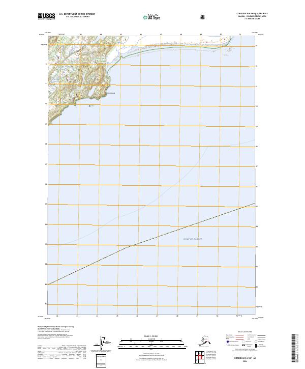
2024 Map of Cordova B-6 SW
USGS Topo · Published 2024About this map
The coastal wilderness of the Chugach National Forest meets the open waters of the Gulf of Alaska in this remote maritime landscape. A prominent geographical marker is Point Steele, where the shoreline turns south, defining the boundary between terrestrial forest and the sea. The map depicts a largely undeveloped region, dominated by the natural topography of the Chugach mountains and the expansive Pacific waters. Surveyed boundaries for township T17S R6W and T17S R5W illustrate the underlying cadastral framework of this Alaskan frontier. The contrast between the dense contour lines of the coastal peaks and the flat expanse of the ocean highlights the dramatic elevation changes characteristic of this portion of the northern coastline.
Find a feature on this map
7 named features on this map. Tap any name to fly to it.
Don’t see what you’re looking for? This feature index may not catch every label — zoom into the map to look around manually.
Map Details
Editions of this 2024 Cordova B-6 SW Map
This is the sole edition of this map. No revisions or reprints were ever made.
Other maps of this area

1948 · Cordova
USGS Topo · 1:250,000

1950 · Cordova B-7
USGS Topo · 1:63,360

1951 · Cordova
USGS Topo · 1:250,000

1951 · Cordova B-6
USGS Topo · 1:63,360

1953 · Cordova B-7
USGS Topo · 1:63,360

1953 · Cordova B-6
USGS Topo · 1:63,360

1959 · Cordova
USGS Topo · 1:250,000
1997 · Cordova B-7
USGS Topo · 1:63,360
2018 · Cordova B-7 NE
USGS Topo · 1:25,000
2018 · Cordova A-7 NE
USGS Topo · 1:25,000