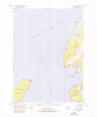
1951 Map of Cordova B-8
USGS Topo · Published 1974About this map
Hinchinbrook Entrance dominates the maritime geography of this 1951 survey, serving as the primary deep-water gateway into Prince William Sound. This coastal environment is defined by the proximity of Montague Island and Hinchinbrook Island, where the terrain rises sharply from the shore to peaks like Signal Mtn. A significant historical detail is the presence of Nuchek (Aband) on the western shore of Hinchinbrook Island, adjacent to Constantine Harbor. This former settlement, accompanied by a Cem, indicates the earlier human footprint in this corner of the Chugach National Forest before it was marked as abandoned. The map also delineates the Hinchinbrook Lighthouse Reserve at the southern tip of the island, a critical navigational landmark near English Bay. Coastal features such as Bear Cape, Pt Barber, and the jagged Schooner Rock provide essential points of reference for those studying the maritime history and topography of the Gulf of Alaska coast.
Find a feature on this map
22 named features on this map. Tap any name to fly to it.
Don’t see what you’re looking for? This feature index may not catch every label — zoom into the map to look around manually.
Map Details
Editions of this 1951 Cordova B-8 Map
Other maps of this area

1948 · Cordova
USGS Topo · 1:250,000

1950 · Cordova C-7
USGS Topo · 1:63,360

1950 · Cordova B-7
USGS Topo · 1:63,360

1950 · Cordova C-8
USGS Topo · 1:63,360

1951 · Seward
USGS Topo · 1:250,000

1951 · Cordova
USGS Topo · 1:250,000

1951 · Seward B-1
USGS Topo · 1:63,360

1951 · Seward A-1
USGS Topo · 1:63,360

1951 · Seward C-1
USGS Topo · 1:63,360

1951 · Cordova B-8
USGS Topo · 1:63,360