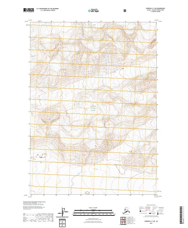
2024 Map of Cordova C-1 NE
USGS Topo · Published 2024About this map
Chugach National Forest encompasses the entirety of this high-altitude landscape, where massive ice fields and glacial meltwater dominate the environment. The northern edge of the sheet is defined by the Wernicke Glacier, while the southern reaches reveal the edges of the Miles Glacier. These frozen features provide an essential look at the glacial movement and hydrological patterns within the Copper River region. The terrain is marked by steep elevation changes and complex drainage systems that feed into the larger glacial basins of south-central Alaska. Without roads or permanent settlements, the map focuses exclusively on the wild interaction between the ice and the surrounding landforms.
Find a feature on this map
7 named features on this map. Tap any name to fly to it.
Don’t see what you’re looking for? This feature index may not catch every label — zoom into the map to look around manually.
Map Details
Editions of this 2024 Cordova C-1 NE Map
This is the sole edition of this map. No revisions or reprints were ever made.
Other maps of this area

1948 · Cordova
USGS Topo · 1:250,000

1950 · Bering Glacier
USGS Topo · 1:250,000

1951 · Bering Glacier
USGS Topo · 1:250,000

1951 · Cordova
USGS Topo · 1:250,000

1959 · Cordova D-1
USGS Topo · 1:63,360

1959 · Cordova C-1
USGS Topo · 1:63,360

1959 · Bering Glacier
USGS Topo · 1:250,000

1959 · Cordova
USGS Topo · 1:250,000
1984 · Bering Glacier D-8
USGS Topo · 1:63,360
1985 · Bering Glacier C-8
USGS Topo · 1:63,360