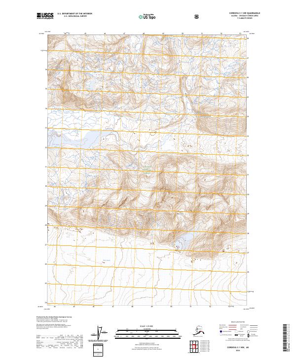
2024 Map of Cordova C-1 NW
USGS Topo · Published 2024About this map
Miles Glacier dominates the southern portion of this landscape, its massive ice front meeting the lowlands at the foot of the Chugach Mountains. Located within the protected boundaries of the Chugach National Forest, the region is defined by the high-altitude topography of the Copper River drainage system. The presence of Van Cleve Lake tucked against the western slopes indicates the dynamic glacial hydrology of the area, where meltwater and ice-dammed features are central to the terrain. This survey illustrates the intricate relationship between the permanent ice fields and the surrounding peaks, providing a clear record of the glacial extent and topographic relief in one of Alaska's most active geological zones.
Find a feature on this map
9 named features on this map. Tap any name to fly to it.
Don’t see what you’re looking for? This feature index may not catch every label — zoom into the map to look around manually.
Map Details
Editions of this 2024 Cordova C-1 NW Map
This is the sole edition of this map. No revisions or reprints were ever made.
Other maps of this area

1948 · Cordova
USGS Topo · 1:250,000

1951 · Cordova
USGS Topo · 1:250,000

1959 · Cordova C-2
USGS Topo · 1:63,360

1959 · Cordova D-1
USGS Topo · 1:63,360

1959 · Cordova D-2
USGS Topo · 1:63,360

1959 · Cordova C-1
USGS Topo · 1:63,360

1959 · Cordova
USGS Topo · 1:250,000
1994 · Cordova D-2
USGS Topo · 1:63,360
2014 · Cordova C-2 NE
USGS Topo · 1:25,000
2014 · Cordova D-1 SE
USGS Topo · 1:25,000