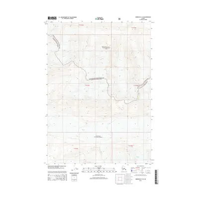
2014 Map of Cordova D-1 SE
USGS Topo · Published 2014About this map
Wernicke Glacier dominates the lower elevations of this high-altitude landscape where the ice flows through deep mountain valleys. This 2014 survey captures a section of the Alaskan wilderness where the Wrangell-Saint Elias National Park meets the Chugach National Forest. The administrative boundary between these two major federal lands meanders across steep contour intervals, following the natural topography of the terrain. The map is a study of extreme relief, defined by the proximity of protected forest lands and the massive ice field of the glacier as it existed at the start of the twenty-first century.
Find a feature on this map
10 named features on this map. Tap any name to fly to it.
Don’t see what you’re looking for? This feature index may not catch every label — zoom into the map to look around manually.
Map Details
Editions of this 2014 Cordova D-1 SE Map
This is the sole edition of this map. No revisions or reprints were ever made.
Other maps of this area

1948 · Cordova
USGS Topo · 1:250,000

1950 · Bering Glacier
USGS Topo · 1:250,000

1951 · Bering Glacier
USGS Topo · 1:250,000

1951 · Cordova
USGS Topo · 1:250,000

1959 · Cordova D-1
USGS Topo · 1:63,360

1959 · Cordova C-1
USGS Topo · 1:63,360

1959 · Bering Glacier
USGS Topo · 1:250,000

1959 · Cordova
USGS Topo · 1:250,000
1984 · Bering Glacier D-8
USGS Topo · 1:63,360
1985 · Bering Glacier C-8
USGS Topo · 1:63,360