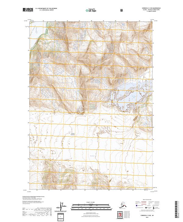
2024 Map of Cordova C-2 NE
USGS Topo · Published 2024About this map
Miles Glacier dominates the southern reaches of this landscape, its massive ice front meeting the Copper River as it winds through the peaks of the Chugach Mountains. This area is preserved within the Chugach National Forest, where the terrain transitions sharply from the deep, carved walls of Baird Canyon to the frozen expanse of the glacier. To the east, Van Cleve Lake sits tucked against the mountainside, a notable glacial feature in this largely untouched wilderness. The survey illustrates the complex glacial drainage patterns and high-altitude topography that characterize this portion of the Alaska range, showing how the river serves as a primary corridor through the high coastal peaks.
Find a feature on this map
10 named features on this map. Tap any name to fly to it.
Don’t see what you’re looking for? This feature index may not catch every label — zoom into the map to look around manually.
Map Details
Editions of this 2024 Cordova C-2 NE Map
This is the sole edition of this map. No revisions or reprints were ever made.
Other maps of this area

1948 · Cordova
USGS Topo · 1:250,000

1951 · Cordova
USGS Topo · 1:250,000

1959 · Cordova C-2
USGS Topo · 1:63,360

1959 · Cordova D-1
USGS Topo · 1:63,360

1959 · Cordova D-2
USGS Topo · 1:63,360

1959 · Cordova C-1
USGS Topo · 1:63,360

1959 · Cordova
USGS Topo · 1:250,000
1994 · Cordova D-2
USGS Topo · 1:63,360
2014 · Cordova C-2 NW
USGS Topo · 1:25,000
2014 · Cordova C-2 NE
USGS Topo · 1:25,000