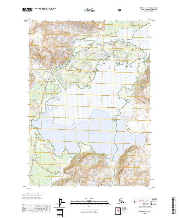
2024 Map of Cordova C-2 NW
USGS Topo · Published 2024About this map
Miles Lake and the massive face of the Miles Glacier dominate this portion of the Chugach National Forest. The landscape is defined by the dynamic interface of ice and water, where the Copper River system flows through complex channels like Chinaman Slough. The topographic data, sourced from modern surveys including the Alaska Dept. of Transportation and the National Hydrography Dataset, illustrates the intricate drainage patterns of Abercrombie Creek as it descends toward the glacial waters. This area represents a critical corridor for northern hydrology, showing the specific reach of the glacier and the resulting silt-laden waterways that have shaped the region's transport and natural history.
Find a feature on this map
9 named features on this map. Tap any name to fly to it.
Don’t see what you’re looking for? This feature index may not catch every label — zoom into the map to look around manually.
Map Details
Editions of this 2024 Cordova C-2 NW Map
This is the sole edition of this map. No revisions or reprints were ever made.
Other maps of this area

1948 · Cordova
USGS Topo · 1:250,000

1950 · Cordova D-3
USGS Topo · 1:63,360

1951 · Cordova
USGS Topo · 1:250,000

1951 · Cordova C-3
USGS Topo · 1:63,360

1953 · Cordova C-3
USGS Topo · 1:63,360

1953 · Cordova D-3
USGS Topo · 1:63,360

1959 · Cordova C-2
USGS Topo · 1:63,360

1959 · Cordova D-2
USGS Topo · 1:63,360

1959 · Cordova
USGS Topo · 1:250,000
1994 · Cordova D-2
USGS Topo · 1:63,360