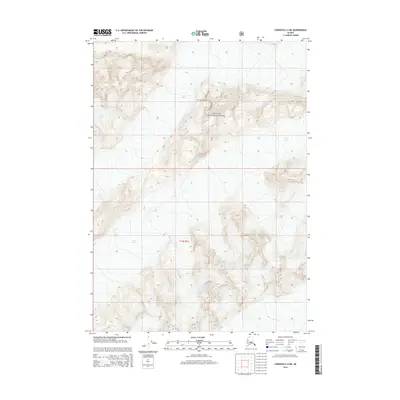
2014 Map of Cordova C-4 NE
USGS Topo · Published 2014About this map
Scott Glacier dominates the northern and eastern portions of this Alaskan landscape, revealing the immense scale of the ice fields within the Chugach National Forest. This 2014 survey by the U.S. Geological Survey details the topographic complexity of the coastal mountains, where steep ridges and high-elevation basins define the geography between the glacial flows. The map provides a clear look at the township and range divisions, including t13s r1e and t14s r1e, illustrating how administrative boundaries are overlaid upon such a formidable natural environment. The lack of roads or established settlements underscores the character of this Unorganized Borough region, which remains primarily defined by its hydrological and glacial features.
Find a feature on this map
4 named features on this map. Tap any name to fly to it.
Don’t see what you’re looking for? This feature index may not catch every label — zoom into the map to look around manually.
Map Details
Editions of this 2014 Cordova C-4 NE Map
This is the sole edition of this map. No revisions or reprints were ever made.
Other maps of this area

1948 · Cordova
USGS Topo · 1:250,000

1950 · Cordova C-4
USGS Topo · 1:63,360

1950 · Cordova D-3
USGS Topo · 1:63,360

1951 · Cordova
USGS Topo · 1:250,000

1951 · Cordova C-3
USGS Topo · 1:63,360

1951 · Cordova D-4
USGS Topo · 1:63,360

1953 · Cordova D-4
USGS Topo · 1:63,360

1953 · Cordova C-3
USGS Topo · 1:63,360

1953 · Cordova C-4
USGS Topo · 1:63,360

1953 · Cordova D-3
USGS Topo · 1:63,360