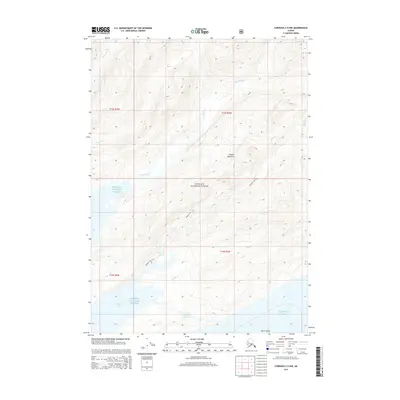
2014 Map of Cordova C-5 NW
USGS Topo · Published 2014About this map
Chugach National Forest encompasses the vast majority of this coastal Alaskan landscape, where the Chugach Mountains meet the waters of Prince William Sound. The terrain is defined by steep elevation changes and a network of drainages including Sheep River and Simpson Cr. Evidence of human activity and navigation is concentrated along the Raging Creek Trail, which winds through the mountain passes. The southern portion of the map reveals the intricate shoreline of Simpson Bay and the open expanse of the Gulf of Alaska. Near the coast, smaller features like Milton Lake and North Island provide specific landmarks for maritime and wilderness navigation. The lack of developed roads reflects the primitive character of this region during the early 21st century.
Find a feature on this map
17 named features on this map. Tap any name to fly to it.
Don’t see what you’re looking for? This feature index may not catch every label — zoom into the map to look around manually.
Map Details
Editions of this 2014 Cordova C-5 NW Map
This is the sole edition of this map. No revisions or reprints were ever made.
Other maps of this area

1948 · Cordova
USGS Topo · 1:250,000

1950 · Cordova C-6
USGS Topo · 1:63,360

1950 · Cordova D-5
USGS Topo · 1:63,360

1951 · Cordova
USGS Topo · 1:250,000

1951 · Cordova C-5
USGS Topo · 1:63,360

1951 · Cordova D-6
USGS Topo · 1:63,360

1953 · Cordova C-6
USGS Topo · 1:63,360

1953 · Cordova D-5
USGS Topo · 1:63,360

1953 · Cordova C-5
USGS Topo · 1:63,360

1953 · Cordova D-6
USGS Topo · 1:63,360