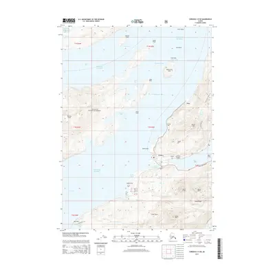
2014 Map of Cordova C-5 SW
USGS Topo · Published 2014About this map
Cordova sits at the edge of Orca Inlet and Eyak Lake, serving as a coastal hub within the expansive Chugach National Forest. This 2014 survey captures the community infrastructure of the region, including the Cordova Municipal Airport and the local Lakeview Cem and Cordova Cem. The landscape is defined by the sharp transition from the maritime waters of Prince William Sound to the high peaks of the Heney Range. The Copper River Highway provides the primary terrestrial link for the settlement, while a network of paths such as the Crater Lake Trail and Heney Ridge Trail penetrate the surrounding mountain terrain. Further north, the smaller settlement of Orca is positioned near Orca Channel, illustrating the region's historical and ongoing reliance on the deep-water passages of the Gulf of Alaska.
Find a feature on this map
65 named features on this map. Tap any name to fly to it.
Don’t see what you’re looking for? This feature index may not catch every label — zoom into the map to look around manually.
Map Details
Editions of this 2014 Cordova C-5 SW Map
This is the sole edition of this map. No revisions or reprints were ever made.
Other maps of this area

1948 · Cordova
USGS Topo · 1:250,000

1950 · Cordova C-6
USGS Topo · 1:63,360

1951 · Cordova
USGS Topo · 1:250,000

1951 · Cordova C-5
USGS Topo · 1:63,360

1951 · Cordova B-5
USGS Topo · 1:63,360

1951 · Cordova B-6
USGS Topo · 1:63,360

1953 · Cordova C-6
USGS Topo · 1:63,360

1953 · Cordova B-5
USGS Topo · 1:63,360

1953 · Cordova C-5
USGS Topo · 1:63,360

1953 · Cordova B-6
USGS Topo · 1:63,360