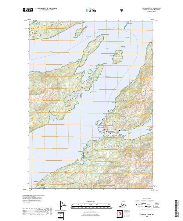
2024 Map of Cordova C-5 SW
USGS Topo · Published 2024About this map
The coastal settlement of Cordova serves as the focal point of this map, situated on the eastern shore of Orca Inlet. This modern topographic study reveals a complex interface of maritime infrastructure and mountainous terrain within the Chugach National Forest. The local geography is defined by the sharp transition from the tidal waters of Odiak Slough and Orca Bay to the steep elevations of Mt Eyak and the Heney Range. Transportation routes like the Copper River Highway and Point Whitshed Road anchor the town's connection to the interior and coastal points, while the Cordova Municipal Airport and Fleming Spit highlight the area's continued reliance on air and sea access. Notable local landmarks for researchers include the Cordova Courthouse, the Lakeview Cem, and the Prince William Sound College - Cordova Campus, documenting the civic and educational layout of this Prince William Sound community.
Find a feature on this map
64 named features on this map. Tap any name to fly to it.
Don’t see what you’re looking for? This feature index may not catch every label — zoom into the map to look around manually.
Map Details
Editions of this 2024 Cordova C-5 SW Map
This is the sole edition of this map. No revisions or reprints were ever made.
Other maps of this area

1948 · Cordova
USGS Topo · 1:250,000

1950 · Cordova C-6
USGS Topo · 1:63,360

1951 · Cordova
USGS Topo · 1:250,000

1951 · Cordova C-5
USGS Topo · 1:63,360

1951 · Cordova B-5
USGS Topo · 1:63,360

1951 · Cordova B-6
USGS Topo · 1:63,360

1953 · Cordova C-6
USGS Topo · 1:63,360

1953 · Cordova B-5
USGS Topo · 1:63,360

1953 · Cordova C-5
USGS Topo · 1:63,360

1953 · Cordova B-6
USGS Topo · 1:63,360