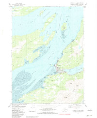
1983 Map of Cordova C-5 SW
USGS Topo · Published 1983About this map
Cordova serves as the central hub of this coastal survey, where the terrestrial landscape meets the complex waterways of Orca Inlet. The settlement is intricately mapped, showing the proximity of the Ferry Terminal to the town's core, along with the Municipal Airport situated between the community and the shores of Eyak Lake. To the east, the Copper River Highway traces the edge of the lake, providing a vital link through the mountainous terrain dominated by Mount Eyak and the Heney Range.
Find a feature on this map
56 named features on this map. Tap any name to fly to it.
Don’t see what you’re looking for? This feature index may not catch every label — zoom into the map to look around manually.
Map Details
Editions of this 1983 Cordova C-5 SW Map
This is the sole edition of this map. No revisions or reprints were ever made.
Other maps of this area

1948 · Cordova
USGS Topo · 1:250,000

1950 · Cordova C-6
USGS Topo · 1:63,360

1951 · Cordova
USGS Topo · 1:250,000

1951 · Cordova C-5
USGS Topo · 1:63,360

1951 · Cordova B-5
USGS Topo · 1:63,360

1951 · Cordova B-6
USGS Topo · 1:63,360

1953 · Cordova C-6
USGS Topo · 1:63,360

1953 · Cordova B-5
USGS Topo · 1:63,360

1953 · Cordova C-5
USGS Topo · 1:63,360

1953 · Cordova B-6
USGS Topo · 1:63,360