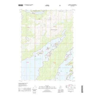
2018 Map of Cordova C-6 NE
USGS Topo · Published 2018About this map
Prince William Sound dominates this coastal survey, where the glacial waters meet the steep southern slopes of the Chugach Mountains. The landscape is almost entirely defined by the Chugach National Forest, a wilderness of deep inlets and high-elevation drainage systems. Waterways such as the Sheep River and Sahlin Cr flow south toward the sound, with the latter featuring the dramatic Sahlin Falls near its mouth. This 2018 edition reveals the intricate coastline of Beartrap Bay and the northern reaches of Sheep Bay, illustrating the complex interaction between mountain runoff and the tidal bays of the Valdez-Cordova region. Small landmarks like North Island in Simpson Bay provide focal points for maritime navigation and local geographic study within this preserved Alaskan corridor.
Find a feature on this map
17 named features on this map. Tap any name to fly to it.
Don’t see what you’re looking for? This feature index may not catch every label — zoom into the map to look around manually.
Map Details
Editions of this 2018 Cordova C-6 NE Map
This is the sole edition of this map. No revisions or reprints were ever made.
Other maps of this area

1948 · Cordova
USGS Topo · 1:250,000

1950 · Cordova C-6
USGS Topo · 1:63,360

1950 · Cordova D-5
USGS Topo · 1:63,360

1951 · Cordova
USGS Topo · 1:250,000

1951 · Cordova C-5
USGS Topo · 1:63,360

1951 · Cordova D-6
USGS Topo · 1:63,360

1953 · Cordova C-6
USGS Topo · 1:63,360

1953 · Cordova D-5
USGS Topo · 1:63,360

1953 · Cordova C-5
USGS Topo · 1:63,360

1953 · Cordova D-6
USGS Topo · 1:63,360