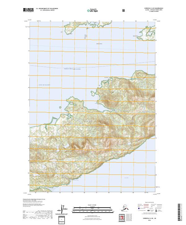
2024 Map of Cordova C-6 SE
USGS Topo · Published 2024About this map
Hawkins Island and the surrounding reaches of Prince William Sound define this coastal landscape within the Chugach National Forest. The map documents a maritime environment where narrow inlets and coves carve into a heavily glaciated or mountainous terrain, particularly around Cedar Bay and Windy Bay. The drainage patterns are clearly visible through short, steep watercourses like Spruce Creek, Hemlock Creek, and Windy Creek, which flow from the interior ridges directly into the surrounding saltwater.
Find a feature on this map
27 named features on this map. Tap any name to fly to it.
Don’t see what you’re looking for? This feature index may not catch every label — zoom into the map to look around manually.
Map Details
Editions of this 2024 Cordova C-6 SE Map
This is the sole edition of this map. No revisions or reprints were ever made.
Other maps of this area

1948 · Cordova
USGS Topo · 1:250,000

1950 · Cordova C-6
USGS Topo · 1:63,360

1951 · Cordova
USGS Topo · 1:250,000

1951 · Cordova C-5
USGS Topo · 1:63,360

1951 · Cordova B-5
USGS Topo · 1:63,360

1951 · Cordova B-6
USGS Topo · 1:63,360

1953 · Cordova C-6
USGS Topo · 1:63,360

1953 · Cordova B-5
USGS Topo · 1:63,360

1953 · Cordova C-5
USGS Topo · 1:63,360

1953 · Cordova B-6
USGS Topo · 1:63,360