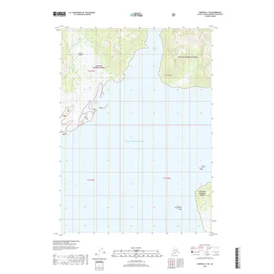
2018 Map of Cordova C-7 NE
USGS Topo · Published 2018About this map
Prince William Sound dominates this coastal survey, where the deep waters of Port Gravina and Saint Matthews Bay meet the steep rise of the Chugach Mountains. Situated within the Chugach National Forest, the landscape is defined by its dramatic maritime geography, showing the intricate shoreline and surrounding tidal features of the Alaska coast. On the western side of the sound, the curiously named Hells Hole provides a distinctive landmark along the coast, while to the southeast, the northern tip of Gravina Island and the nearby Gravina Rocks emerge from the water. This 2018 data illustrates the intersection of vast public lands and protected waterways in the Unorganized Borough, focusing on the natural contours of the land rather than human settlement, preserving the character of the Alaskan wilderness.
Find a feature on this map
13 named features on this map. Tap any name to fly to it.
Don’t see what you’re looking for? This feature index may not catch every label — zoom into the map to look around manually.
Map Details
Editions of this 2018 Cordova C-7 NE Map
This is the sole edition of this map. No revisions or reprints were ever made.
Other maps of this area

1948 · Cordova
USGS Topo · 1:250,000

1950 · Cordova C-7
USGS Topo · 1:63,360

1950 · Cordova C-6
USGS Topo · 1:63,360

1950 · Cordova D-7
USGS Topo · 1:63,360

1951 · Cordova
USGS Topo · 1:250,000

1951 · Cordova D-6
USGS Topo · 1:63,360

1952 · Cordova D-7
USGS Topo · 1:63,360

1953 · Cordova C-6
USGS Topo · 1:63,360
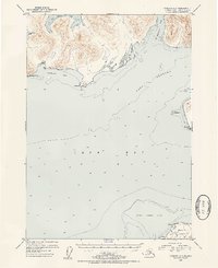
1953 · Cordova C-7
USGS Topo · 1:63,360

1953 · Cordova D-6
USGS Topo · 1:63,360