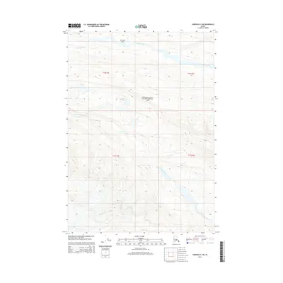
2014 Map of Cordova D-1 NE
USGS Topo · Published 2014About this map
Wrangell-Saint Elias National Park encompasses the majority of this Alaskan wilderness, dominated by the glacial drainage systems of the Chugach Mountains. The northern reach of the map follows the winding course of the Bremner River, where it cuts through Threemile Canyon. This deep incision in the landscape suggests a powerful erosive force against the local geology, providing a corridor for water transit through the high terrain. Further south, the S Fork Bremner River meanders across a broad, glaciated valley before narrowing between steep contour lines. The absence of roads or established settlements on this 2014 survey highlights the preserved state of this region, which remains primarily defined by its topographic extremes and river networks.
Find a feature on this map
8 named features on this map. Tap any name to fly to it.
Don’t see what you’re looking for? This feature index may not catch every label — zoom into the map to look around manually.
Map Details
Editions of this 2014 Cordova D-1 NE Map
This is the sole edition of this map. No revisions or reprints were ever made.
Other maps of this area

1948 · Cordova
USGS Topo · 1:250,000

1950 · McCarthy A-8
USGS Topo · 1:63,360

1950 · Bering Glacier
USGS Topo · 1:250,000

1951 · McCarthy
USGS Topo · 1:250,000

1951 · Bering Glacier
USGS Topo · 1:250,000

1951 · Cordova
USGS Topo · 1:250,000

1951 · Valdez A-1
USGS Topo · 1:63,360

1952 · Valdez
USGS Topo · 1:250,000

1959 · Cordova D-1
USGS Topo · 1:63,360

1959 · Bering Glacier
USGS Topo · 1:250,000