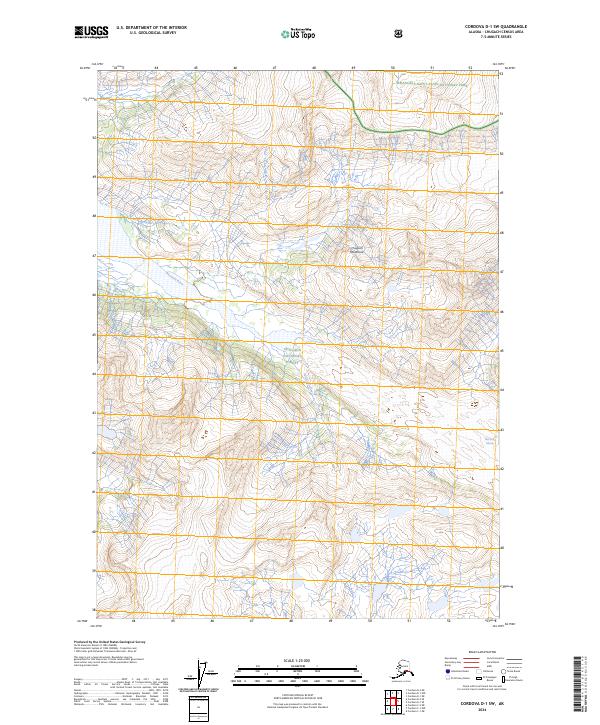
2024 Map of Cordova D-1 SW
USGS Topo · Published 2024About this map
The Chugach Mountains dominate this high-latitude terrain where the Chugach National Forest meets the boundaries of Wrangell-Saint Elias National Park. The landscape is defined by the hydrologic path of the Wernicke River, which drains the southern reaches of the quadrangle. In the northeast, the Wrangell-St. Elias Wilderness protects a high-altitude expanse of peaks and ice, including the terminal edge of the Wernicke Glacier. This 2024 map documents a wilderness area largely devoid of human infrastructure, showing instead the intricate contour lines and drainage patterns of the Alaskan interior. The intersection of these major federal conservation units creates a contiguous protected corridor, illustrating the scale of land management in this portion of the state.
Find a feature on this map
12 named features on this map. Tap any name to fly to it.
Don’t see what you’re looking for? This feature index may not catch every label — zoom into the map to look around manually.
Map Details
Editions of this 2024 Cordova D-1 SW Map
This is the sole edition of this map. No revisions or reprints were ever made.
Other maps of this area

1948 · Cordova
USGS Topo · 1:250,000

1951 · Cordova
USGS Topo · 1:250,000

1959 · Cordova C-2
USGS Topo · 1:63,360

1959 · Cordova D-1
USGS Topo · 1:63,360

1959 · Cordova D-2
USGS Topo · 1:63,360

1959 · Cordova C-1
USGS Topo · 1:63,360

1959 · Cordova
USGS Topo · 1:250,000
1994 · Cordova D-2
USGS Topo · 1:63,360
2014 · Cordova C-2 NE
USGS Topo · 1:25,000
2014 · Cordova D-1 SE
USGS Topo · 1:25,000