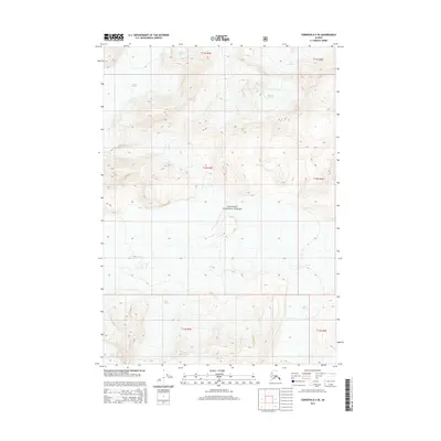
2014 Map of Cordova D-3 SE
USGS Topo · Published 2014About this map
Heney Glacier and Shiels Glacier dominate the northern terrain of this high-altitude landscape within the Chugach National Forest. The map documents a strictly glacial and mountainous environment where ice flows define the geography, including the extensive reach of the Allen Glacier in the southern sections. This 2014 survey serves as a modern record of glacial extent and alpine topography in a region devoid of permanent settlements or roads. The technical data provided by the U.S. Geological Survey and the US Forest Service highlights the complex drainage and elevation patterns of the McCune Glacier area, offering researchers a precise baseline for studying changes in the Alaskan ice fields.
Find a feature on this map
11 named features on this map. Tap any name to fly to it.
Don’t see what you’re looking for? This feature index may not catch every label — zoom into the map to look around manually.
Map Details
Editions of this 2014 Cordova D-3 SE Map
This is the sole edition of this map. No revisions or reprints were ever made.
Other maps of this area

1948 · Cordova
USGS Topo · 1:250,000

1950 · Cordova D-3
USGS Topo · 1:63,360

1951 · Cordova
USGS Topo · 1:250,000

1951 · Cordova C-3
USGS Topo · 1:63,360

1953 · Cordova C-3
USGS Topo · 1:63,360

1953 · Cordova D-3
USGS Topo · 1:63,360

1959 · Cordova C-2
USGS Topo · 1:63,360

1959 · Cordova D-2
USGS Topo · 1:63,360

1959 · Cordova
USGS Topo · 1:250,000
1994 · Cordova D-2
USGS Topo · 1:63,360