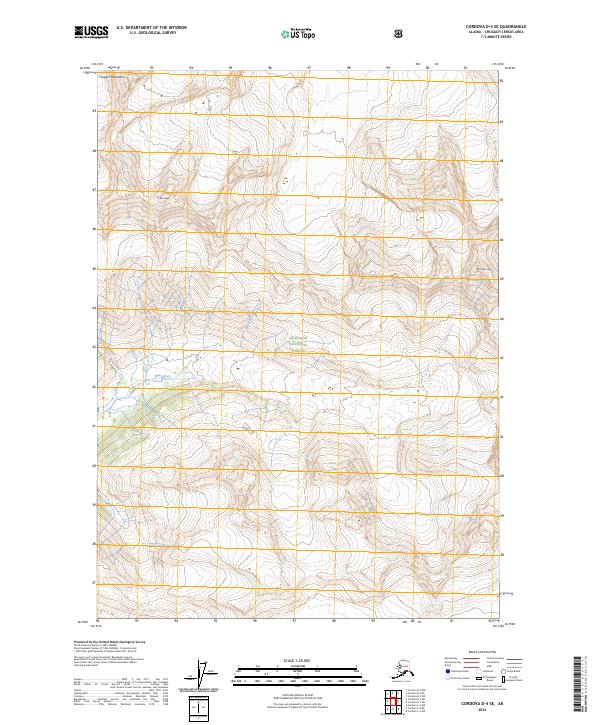
2024 Map of Cordova D-4 SE
USGS Topo · Published 2024About this map
Chugach National Forest dominates this topographic study, encompassing a high-elevation landscape defined by the sharp peaks of the Chugach Mountains. The terrain is characterized by massive vertical relief, where prominent summits like Cordova Peak and Mt Chasin Few rise above the drainage basins below. The Rude River winds through the southwestern portion of the map, providing a primary hydrological feature in an otherwise glaciated and mountainous environment. This 2024 survey documents the contemporary boundaries and topographical contours of the Chugach National Forest near the Chugach Census Area, capturing the intersection of major township lines including t11s r1e, t12s r1e, and t13s r1e. The absence of roads or developed settlements highlights the wild character of this region of the Alaska coast, where the landscape is governed by alpine elevation and river valleys.
Find a feature on this map
11 named features on this map. Tap any name to fly to it.
Don’t see what you’re looking for? This feature index may not catch every label — zoom into the map to look around manually.
Map Details
Editions of this 2024 Cordova D-4 SE Map
This is the sole edition of this map. No revisions or reprints were ever made.
Other maps of this area

1948 · Cordova
USGS Topo · 1:250,000

1950 · Cordova C-4
USGS Topo · 1:63,360

1950 · Cordova D-3
USGS Topo · 1:63,360

1951 · Cordova
USGS Topo · 1:250,000

1951 · Cordova C-3
USGS Topo · 1:63,360

1951 · Cordova D-4
USGS Topo · 1:63,360

1953 · Cordova D-4
USGS Topo · 1:63,360

1953 · Cordova C-3
USGS Topo · 1:63,360

1953 · Cordova C-4
USGS Topo · 1:63,360

1953 · Cordova D-3
USGS Topo · 1:63,360