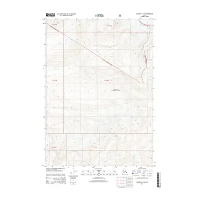
2014 Map of Cordova D-5 SW
USGS Topo · Published 2014About this map
Chugach National Forest encompasses the entirety of this mountainous terrain in the Unorganized Borough, where the high-altitude landscape is defined by the Cordova Glacier in the northeast corner. The area serves as a significant drainage basin for several glacial and mountain-fed waterways, including the Gravina River which cuts through the central portion of the quadrangle. In the south, the Sheep River and the headwaters of Simpson Creek flow through deep valleys carved between high ridges. This 2014 survey documents a wilderness area devoid of permanent human settlements or roads, focusing instead on the complex topography and the precise boundaries of Township and Range lines including t12s r3w and t12s r4w.
Find a feature on this map
11 named features on this map. Tap any name to fly to it.
Don’t see what you’re looking for? This feature index may not catch every label — zoom into the map to look around manually.
Map Details
Editions of this 2014 Cordova D-5 SW Map
This is the sole edition of this map. No revisions or reprints were ever made.
Other maps of this area

1948 · Cordova
USGS Topo · 1:250,000

1950 · Cordova C-6
USGS Topo · 1:63,360

1950 · Cordova D-5
USGS Topo · 1:63,360

1951 · Cordova
USGS Topo · 1:250,000

1951 · Cordova C-5
USGS Topo · 1:63,360

1951 · Cordova D-6
USGS Topo · 1:63,360

1953 · Cordova C-6
USGS Topo · 1:63,360

1953 · Cordova D-5
USGS Topo · 1:63,360

1953 · Cordova C-5
USGS Topo · 1:63,360

1953 · Cordova D-6
USGS Topo · 1:63,360