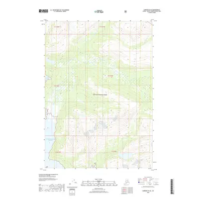
2018 Map of Cordova D-6 SE
USGS Topo · Published 2018About this map
Chugach National Forest encompasses this coastal Alaskan landscape, where the terrestrial wilderness meets the tidal waters of Prince William Sound. The terrain is defined by the drainage systems of the Gravina River and Dead Cr, which carve through the steep elevations that characterize this portion of the Unorganized Borough. This 2018 survey documents the intricate glacial and fluvial topography of the region, showing how the river systems navigate between high ridges. The absence of permanent settlements or roads emphasizes the primitive character of the forest land, making this a critical record for understanding the hydrological patterns and untouched boundaries within the t12s r4w and t13s r5w townships.
Find a feature on this map
10 named features on this map. Tap any name to fly to it.
Don’t see what you’re looking for? This feature index may not catch every label — zoom into the map to look around manually.
Map Details
Editions of this 2018 Cordova D-6 SE Map
This is the sole edition of this map. No revisions or reprints were ever made.
Other maps of this area

1948 · Cordova
USGS Topo · 1:250,000

1950 · Cordova C-6
USGS Topo · 1:63,360

1950 · Cordova D-5
USGS Topo · 1:63,360

1951 · Cordova
USGS Topo · 1:250,000

1951 · Cordova C-5
USGS Topo · 1:63,360

1951 · Cordova D-6
USGS Topo · 1:63,360

1953 · Cordova C-6
USGS Topo · 1:63,360

1953 · Cordova D-5
USGS Topo · 1:63,360

1953 · Cordova C-5
USGS Topo · 1:63,360

1953 · Cordova D-6
USGS Topo · 1:63,360