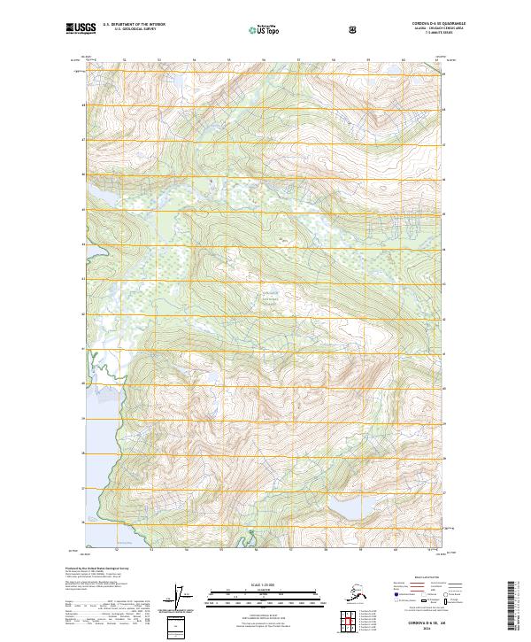
2024 Map of Cordova D-6 SE
USGS Topo · Published 2024About this map
The Chugach National Forest dominates this Alaskan landscape, where the Gravina River carves its way through the steep terrain toward the southern coastline. This 2024 survey captures the untouched character of the wilderness surrounding Beartrap Bay, a saltwater inlet that serves as a primary geographic anchor at the bottom of the sheet. The drainage patterns of the region are defined by features like Dead Creek, which feeds into the complex river systems characteristic of this part of the Chugach Census Area. This map is an essential reference for understanding the modern hydrological boundaries and forest conservation zones in a region where natural features remain the primary landmarks.
Find a feature on this map
10 named features on this map. Tap any name to fly to it.
Don’t see what you’re looking for? This feature index may not catch every label — zoom into the map to look around manually.
Map Details
Editions of this 2024 Cordova D-6 SE Map
This is the sole edition of this map. No revisions or reprints were ever made.
Other maps of this area

1948 · Cordova
USGS Topo · 1:250,000

1950 · Cordova C-6
USGS Topo · 1:63,360

1950 · Cordova D-5
USGS Topo · 1:63,360

1951 · Cordova
USGS Topo · 1:250,000

1951 · Cordova C-5
USGS Topo · 1:63,360

1951 · Cordova D-6
USGS Topo · 1:63,360

1953 · Cordova C-6
USGS Topo · 1:63,360

1953 · Cordova D-5
USGS Topo · 1:63,360

1953 · Cordova C-5
USGS Topo · 1:63,360

1953 · Cordova D-6
USGS Topo · 1:63,360