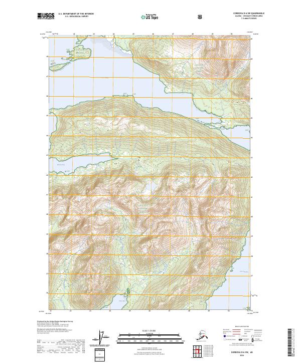
2024 Map of Cordova D-6 SW
USGS Topo · Published 2024About this map
Chugach National Forest dominates this Alaskan coastal wilderness, where the steep terrain of the Chugach Mountains meets the intricate shorelines of Prince William Sound. The map focuses on the high ridges and deep drainages situated between the maritime reaches of Port Fidalgo to the north and Port Gravina to the south. This area is characterized by short, steep glacial drainages like West Fork Olsen Bay Creek and East Fork Olsen Bay Creek, which empty into the protected waters of Olsen Bay. To the west, the indentation of Whalen Bay provides another sea-level landmark in an otherwise vertical landscape. The map illustrates the specialized hydrology of the region, where numerous unnamed mountain streams feed larger named arteries like Control Creek, reflecting a landscape defined entirely by its natural water cycles and forest boundaries rather than human settlement.
Find a feature on this map
14 named features on this map. Tap any name to fly to it.
Don’t see what you’re looking for? This feature index may not catch every label — zoom into the map to look around manually.
Map Details
Editions of this 2024 Cordova D-6 SW Map
This is the sole edition of this map. No revisions or reprints were ever made.
Other maps of this area

1948 · Cordova
USGS Topo · 1:250,000

1950 · Cordova C-7
USGS Topo · 1:63,360

1950 · Cordova C-6
USGS Topo · 1:63,360

1950 · Cordova D-7
USGS Topo · 1:63,360

1951 · Cordova
USGS Topo · 1:250,000

1951 · Cordova D-6
USGS Topo · 1:63,360

1952 · Cordova D-7
USGS Topo · 1:63,360

1953 · Cordova C-6
USGS Topo · 1:63,360
1953 · Cordova C-7
USGS Topo · 1:63,360

1953 · Cordova D-6
USGS Topo · 1:63,360